Wikiloc is a globally connected outdoor exploration and route-sharing platform designed for hikers, cyclists, runners, and adventure seekers who want to discover, record, and share authentic GPS-based trails. With over 50 million routes spanning 80+ outdoor activities, the app leverages user-generated content to enable personalized adventures, reliable navigation, and real-time connectivity across mobile devices and GPS-compatible smartwatches. Wikiloc serves as both a practical tool for outdoor navigation and a vibrant community for nature enthusiasts to exchange their discoveries.
Trail Discovery Across 80+ Outdoor Activities
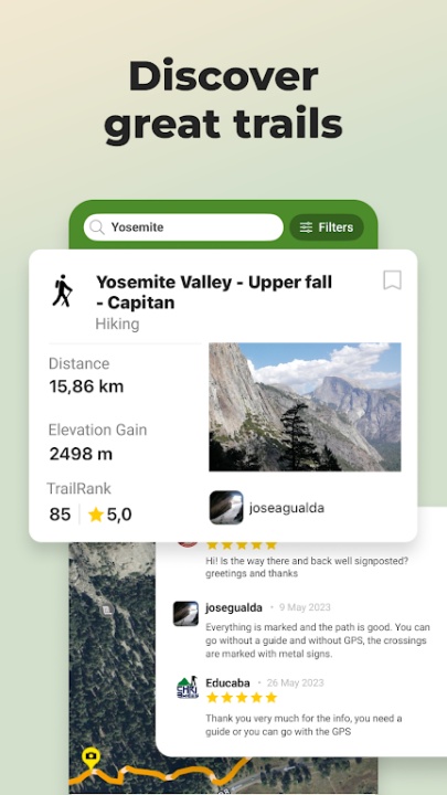
- Search among millions of community-uploaded routes including hiking, trail running, gravel biking, mountain biking, kayaking, climbing, skiing, and mountaineering
- Access location-specific paths in national parks, rural areas, coastal regions, and urban landscapes
- Explore curated trails adjusted for varied skill levels, seasonal conditions, and terrain types
Authentic GPS-Recorded Routes by the Community
- Routes are contributed and validated by active outdoor users using real GPS devices or mobile apps
- Discover itineraries from local explorers, travelers, and professional guides
- Each route includes photos, waypoints, elevation profiles, and environmental details
- Engage with verified trail content rather than generic or untested paths
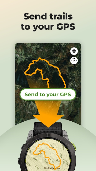
GPS and Smartwatch Integration
- Send trails directly to Garmin, Suunto, COROS, and Wear OS devices for wrist-based navigation
- Compatible with models such as Garmin Forerunner, Edge, Fenix, Epix, and Samsung Galaxy Watch
- Track, record, and follow routes in real time from smartwatches with Wear OS 3 or higher
- Route syncing ensures quick setup before heading out into remote environments
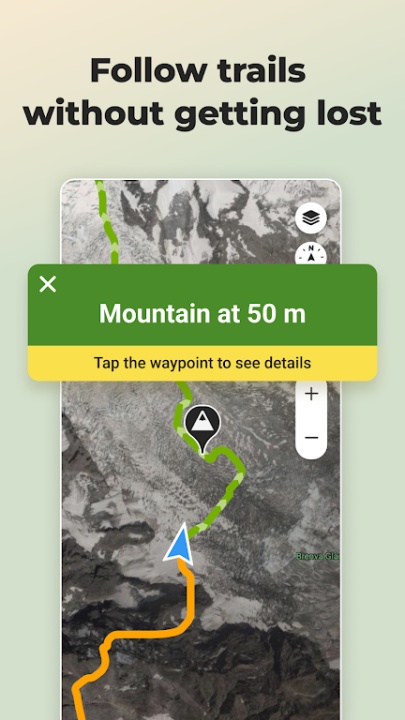
Real-Time Outdoor Navigation Tools
- Use your mobile phone or smartwatch as a guided outdoor GPS system
- Directional indicators and off-route alerts help prevent deviation from the intended path
- Enable live tracking to share your current location with trusted contacts
- Stay safe and informed even in isolated or unfamiliar areas
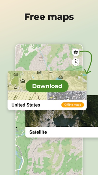
Offline Navigation and Topographic Mapping
- Download free global topographic maps to ensure functionality without mobile signal or internet
- Designed for use in areas with low or no connectivity such as high-altitude trails, forested zones, or backcountry areas
- Efficient for travelers concerned with battery preservation and rural navigation
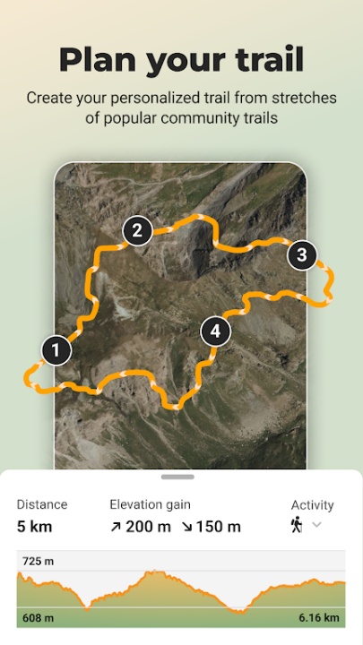
Route Planning and Premium Exploration Tools
- Use Route Planner to create custom paths based on waypoints and community trails
- Explore 3D map views to analyze terrain, elevation gain, and panoramic perspectives before committing
- Refine trail searches using advanced filters including difficulty, distance, elevation change, and seasonal suitability
- Search for trails passing through specific landmarks or geographic zones for targeted outings
- Check weather forecasts to prepare adequately for your planned route
Outdoor Recording and Social Sharing
- Capture your own routes with mobile GPS tracking
- Add waypoints, photos, notes, and descriptions to enrich your route documentation
- Share your completed adventures with followers, friends, or the broader Wikiloc community
- Gain visibility by contributing quality trail content that others can use and trust
Accessibility and Inclusive Route Design
- Discover trails adapted for reduced mobility or visual impairment
- Support inclusive outdoor activity through accessible mapping and navigation
- Find and follow designated safe routes suitable for wheelchairs and other mobility aids
Environmental Contribution with Premium Membership
- Contribute to environmental preservation by subscribing to Wikiloc Premium
- 1% of every Premium purchase is donated to 1% for the Planet to fund global conservation efforts
- Support continued app development while directly investing in sustainability
Frequently Asked Questions
Q: Can I use Wikiloc offline?
Yes, you can download topographic maps and navigate without internet access.
Q: Is route sharing limited to specific activities?
No, users can share and discover routes across more than 80 activity types.
Q: Does the app work with smartwatches?
Yes, it supports Garmin, Suunto, COROS, and Wear OS 3 or higher devices.
Q: Are community routes verified?
Routes are GPS-recorded by users and often include photos and comments to guide others.
Q: Can I track my location in real time?
Yes, live GPS tracking is available to share your position with friends and family.
Q: Is there a feature for planning custom routes?
Yes, the Route Planner lets you create personalized trails using waypoints.
Q: Do I need Premium to use the basic navigation tools?
No, basic features are free, but Premium offers advanced search and planning options.
Q: Is there an environmental impact from subscribing?
Yes, 1% of Premium payments go to support global environmental initiatives.
Version History
v3.52.5 —— 18 Jul 2025
New Feature: Place of the Day Widget • Displays a unique daily location directly on the Home Screen • Designed to inspire outdoor exploration by showcasing hidden gems
v3.52.4 —— 8 Jul 2025
Same feature rollout as v3.52.5—continues support and optimization for daily location widget
v3.51.16 —— 25 Jun 2025
Identical feature update—launch of Home Screen widget spotlighting remarkable outdoor destinations