Make accurate land measurement easy with a comprehensive GPS-powered solution built for surveyors, farmers, developers, and outdoor professionals. GLandMeasure combines high-precision mapping with advanced analytics and robust export tools, making it ideal for managing field boundaries, calculating area and distance, and documenting terrain data in multiple formats.
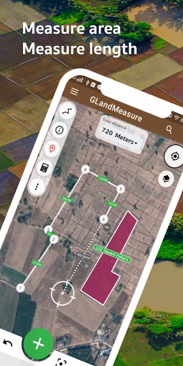
Land Measurement and Perimeter Mapping
- Use GPS-guided positioning to measure land areas with high accuracy
- Walk the perimeter of any plot to calculate boundaries in real time
- Ideal for non-linear shapes, agricultural fields, and residential plots
- Access tools for calculating distance, perimeter, and overall acreage instantly
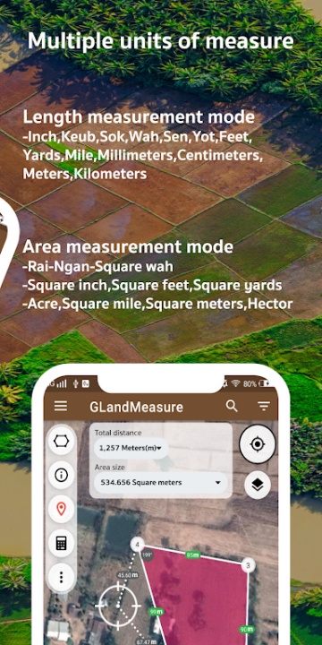
Unit Conversion and Regional Support
- Switch between units such as hectares, acres, square meters, square feet, kilometers, miles, and yards
- Support for both metric and imperial systems for global usability
- Simplify measurements based on project or location needs
Advanced GIS and Survey Tools
- Analyze terrain with contour lines and elevation data for topographical understanding
- Estimate soil volume for construction or landscaping use via cut-and-fill tools
- Integrate real-time weather predictions for accurate field planning
- Perform tree count estimations to support forestry and zoning assessments
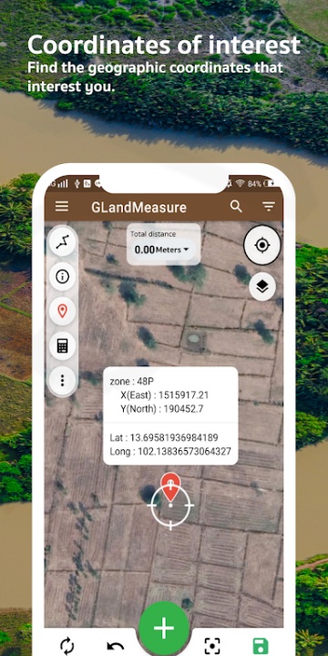
Coordinate System Compatibility
- Work with GEO, UTM, DMS, MGRS, Geohash, and Plus Code coordinate formats
- Map and tag locations using reliable GPS data and labeling tools
- Save, manage, and retrieve points of interest and survey markers easily
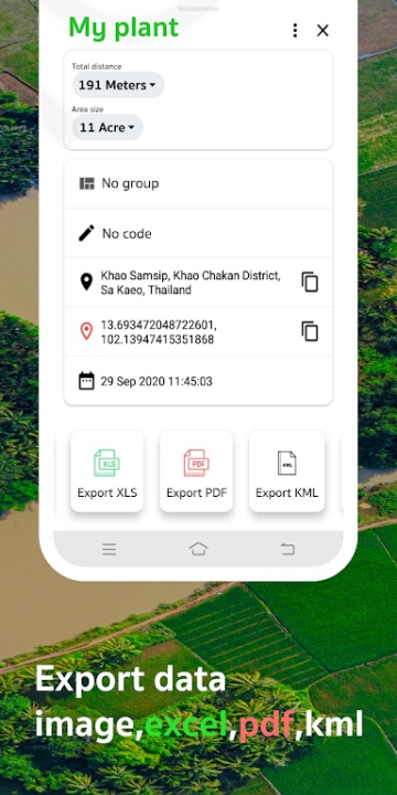
Export and File Sharing Options
- Export survey data in professional-grade formats including KML, GeoJSON, CSV, and PDF
- Share maps and location data via cloud or device storage
- Generate custom reports for planning, legal submission, or client presentations
Integrated Visual Tools
- Use satellite map overlays for clear visualization and layout planning
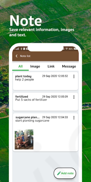
- Capture geo-tagged images to link visual references with mapped coordinates
- Employ built-in GPS speedometer to ensure walk mapping accuracy
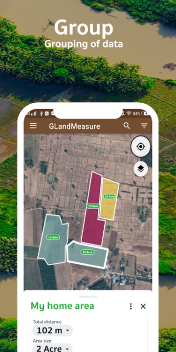
User Profiles
- Tailored for landowners, farmers, developers, GIS analysts, engineers, and planners
- Supports individual property mapping or multi-plot area tracking
- A practical tool for daily measurements or long-term land management
Frequently Asked Questions
Q: Can I measure plots without internet?
A: Yes, GPS tools and offline maps allow measurements without network access.
Q: What formats can I export data in?
A: You can export in KML, GeoJSON, CSV, and PDF.
Q: Is elevation data included?
A: Yes, terrain and altitude information are integrated with contour analysis.
Q: Can I measure land by walking its boundary?
A: Yes, walking mode helps you trace irregular shapes precisely.
Q: Are unit conversions supported?
A: Yes, you can easily switch between multiple standard units.
Q: Is weather info available for my location?
A: Yes, local forecasts are available within the app’s dashboard.
Q: Can I capture field photos with location tags?
A: Yes, the GIS Camera tool allows geo-tagged photo documentation.
Q: Is the app suitable for forestry use?
A: Yes, tools include tree estimation and terrain analysis for forest planning.
Q: Can I manage multiple survey files?
A: Yes, you can save, organize, and retrieve multiple projects.
Q: Does it support different coordinate systems?
A: Yes, the app works with several global and regional formats.
Version History
v3.23.3 ---- 28 Jul 2025
Welcome to GLandMeasure version 3, the new edition
Land measurement and length calculation made easier by dragging coordinates
Share and forward information to social media such as Facebook and others
Added functions: import KML, calculate land volume, measure land elevation, calculate trees, added image layer
Add points of interest
Separate project creation
Camera added to the app
Added GeoJson, Geohash
v3.23.2 ---- 11 Jul 2025
Welcome to GLandMeasure version 3, the new edition
Land measurement and length calculation made easier by dragging coordinates
Share and forward information to social media such as Facebook and others
Added functions: import KML, calculate land volume, measure land elevation, calculate trees, added image layer
Add points of interest
Separate project creation
Camera added to the app
Added GeoJson, Geohash
v3.23.1 ---- 01 Jul 2025
Welcome to GLandMeasure version 3, the new edition
Land measurement and length calculation made easier by dragging coordinates
Share and forward information to social media such as Facebook and others
Added functions: import KML, calculate land volume, measure land elevation, calculate trees, added image layer
Add points of interest
Separate project creation
Camera added to the app
Added GeoJson, Geohash