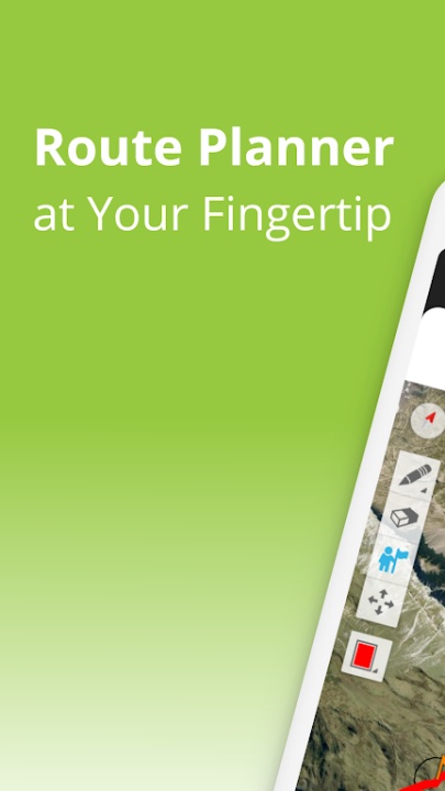
TouchTrails is an intuitive route planning and navigation tool designed for outdoor enthusiasts who want to map, track, and explore trails with precision. Whether planning a cycling trip, a multi-day hiking adventure, or an off-road journey, TouchTrails provides accurate distance measurements, elevation profiles, and turn-by-turn voice navigation to enhance your experience. With flexible route customization, GPS tracking, and waypoint editing, TouchTrails ensures that every adventure is well-planned and seamlessly executed.
Key Features
Custom Route Planning & Navigation
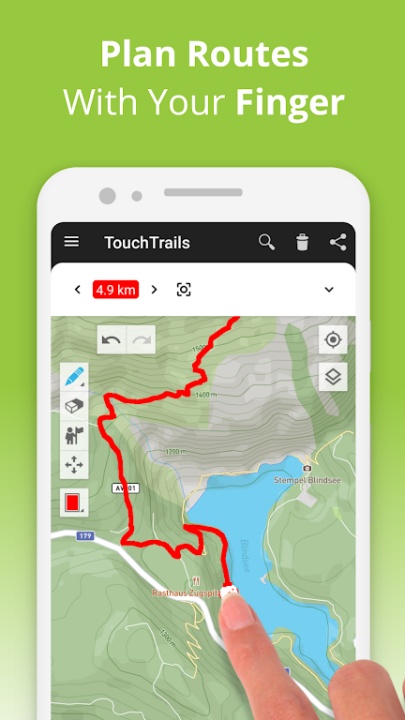
- Finger-Drawn Routes – Easily trace paths on the map with your finger for instant route creation.
- Snap to Road – Automatically align routes to roads, bike paths, and hiking trails for accuracy.
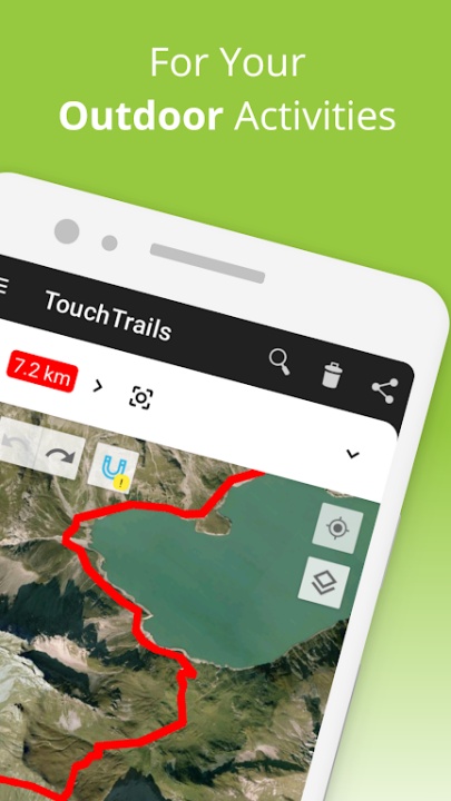
- Off-Road Flexibility – Plan routes beyond standard paths for unique outdoor experiences.
Distance & Elevation Tracking
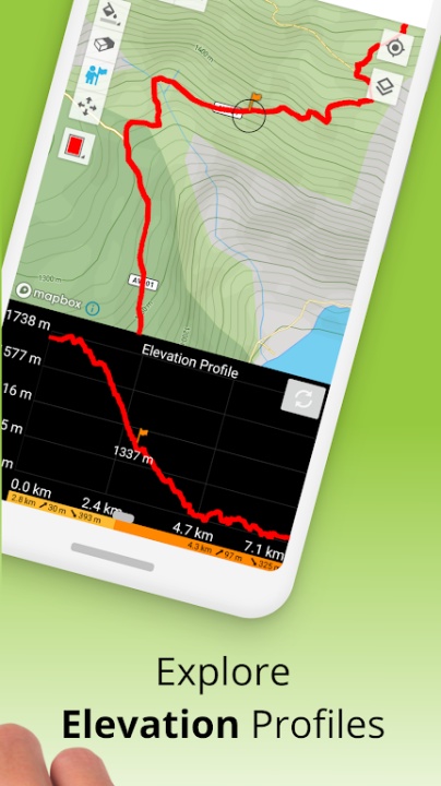
- Accurate Distance Measurements – Understand how far your journey will take you.
- Detailed Elevation Profiles – Analyze elevation changes to prepare for climbs and descents.
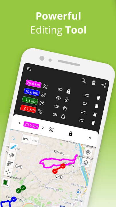
Waypoint Editing & Customization
- Highlight Key Locations – Add waypoints for points of interest, tips, and landmarks.
- Extensive Icon Library – Customize maps with a variety of waypoint symbols.
GPS Tracking & Route Recording
- Real-Time GPS Tracker – Record your adventures and save them for future reference.
- Route Editing & Sharing – Modify recorded routes and share them with friends.
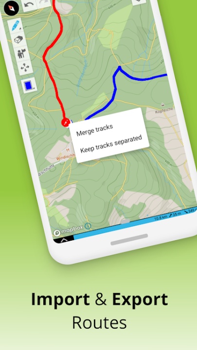
GPX File Import & Multi-Route Viewing
- GPX Viewer – Import trails from external sources and navigate along them.
- Multiple Routes on One Map – View and combine different routes simultaneously.
TouchTrails Premium Features
- Turn-by-Turn Navigation – Receive audio directions and alerts when leaving the route.
- Unlimited Route Saving – Store and manage an extensive collection of planned routes.
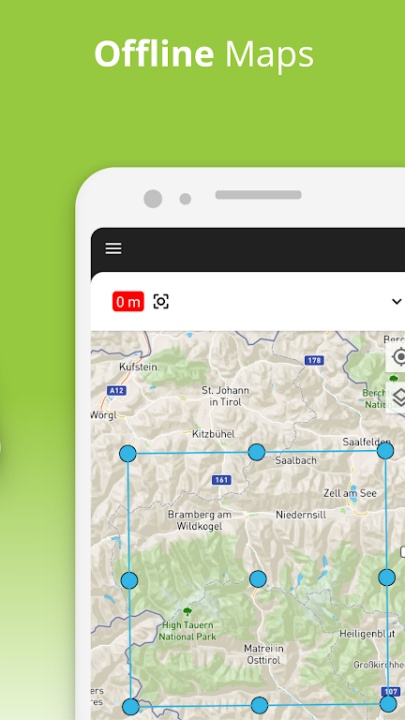
- Offline Maps – Access maps even when an internet connection is unavailable.
- GPX File Export – Share and back up routes with external applications.
Why Choose TouchTrails?
- Provides flexible route planning with finger-drawn paths and snap-to-road functionality.
- Offers detailed distance and elevation tracking for better adventure preparation.
Supports GPS tracking, waypoint customization, and multi-route viewing for enhanced navigation.
Frequently Asked Questions
Q: Can I plan off-road routes with TouchTrails?
A: Yes, TouchTrails allows users to create routes beyond standard roads and trails.
Q: Does TouchTrails support turn-by-turn navigation?
A: Yes, the premium version provides voice-guided navigation and route alerts.
Q: Can I import GPX files into TouchTrails?
A: Yes, users can import GPX files from external sources and edit them as needed.
Q: Does TouchTrails work offline?
A: Yes, premium users can access offline maps for navigation without an internet connection.
Q: Where can I find more information about TouchTrails?
A: Visit the official website attouchtrails.com for updates and user guides.
Version History
v2.12.0 ---- 12 Jun 2024
- Bug fixes and improvements.
v2.6.10 ---- 27 Oct 2023
- Bug Fixes and improvements.
v2.4.5 ---- 27 Oct 2023
- Bug fixes and improvements.