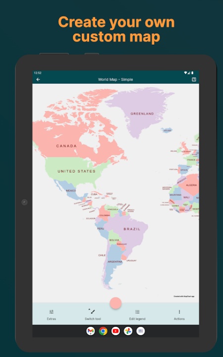
Design stunning custom maps with ease using a versatile map visualization app tailored for geography lovers, educators, gamers, and creative storytellers. With a massive catalog of regional, historical, political, fantasy, and game-based maps, users can color, customize, and export vibrant cartographic creations for use in projects, presentations, or personal collections. Whether you're charting alternate timelines, marking travel plans, or exploring historical borders, this app puts interactive cartography at your fingertips with intuitive tools and flexible export options.
Extensive Map Selection
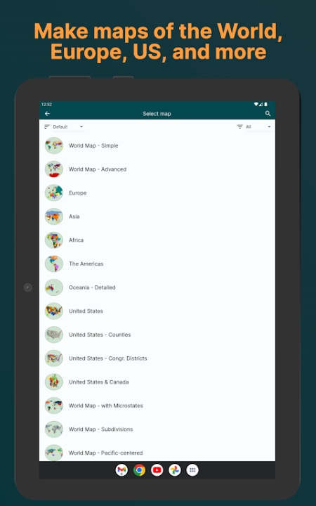
- Create maps from a wide range of categories including world regions, individual countries, and political subdivisions
- Access specialized maps for U.S. states, counties, and congressional districts
- Browse historical layouts from major global events including World War I, World War II, and eras like 1815 or 1938
- Choose fantasy maps such as Tamriel and Westeros or video game universes from Hearts of Iron IV, Victoria 3, and Europa Universalis IV
- New maps and regions added regularly for expanded creative options
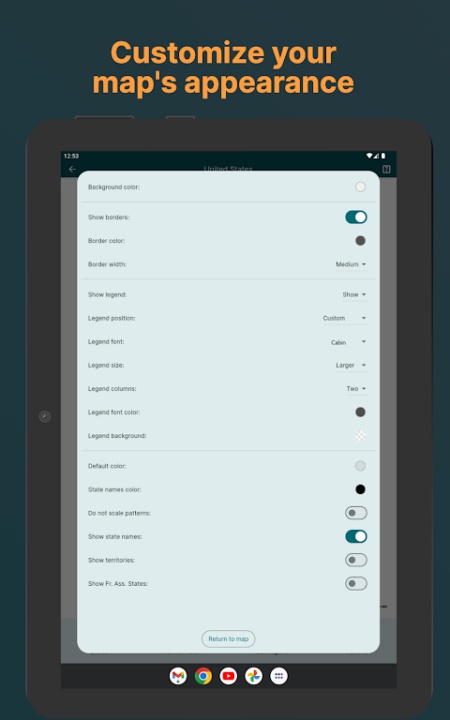
Interactive Map Customization
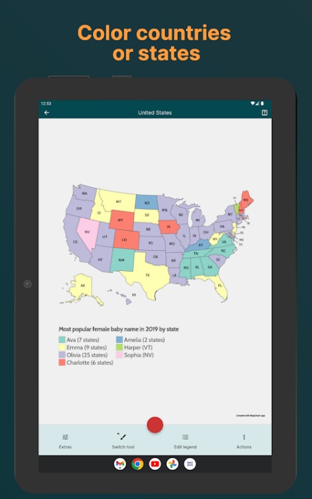
- Color each region manually with your favorite shades or thematic palettes
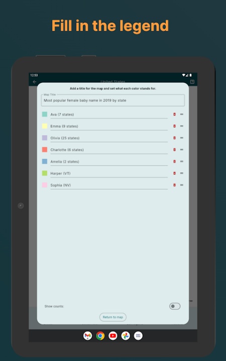
- Add legends to identify key areas and communicate map data clearly
- Use background editing tools and pattern overlays to enhance visual storytelling
- Adjust layout and labeling options to reflect personal or professional needs
Save and Reuse Your Maps
- Store unlimited map designs directly on your device with save and load functionality
- Easily revisit previous creations for updates, revisions, or new variations
- Export finished maps to your gallery or external storage in image format
Sharing and Publishing Tools
- Download completed maps for offline viewing or project integration
- Share designs on social media, websites, educational platforms, or in print
- Compatible with blogs, presentations, digital storytelling formats, and academic use
Premium Customization Features
- Unlock dark theme for improved visibility during night use or professional settings
- Access unlimited saved maps, exclusive color palettes, rare map themes, and personalized app icons
- Enjoy an ad-free experience with a one-time upgrade for distraction-free usage
Built for Offline Use
- All editing, saving, and export functions work without internet connectivity
- Perfect for travel, classrooms, remote learning, or on-the-go content creation
- Map access and project editing are available anytime
Frequently Asked Questions
Q: Can I use the app offline?
Yes, all core features including saving and editing work without internet access.
Q: Does it support custom legends and labels?
Yes, users can add legends and modify map text for clear communication.
Q: Are there fantasy or video game maps available?
Yes, maps from games and fictional worlds like Tamriel and Westeros are included.
Q: Can I save multiple maps?
Yes, and premium users enjoy unlimited saved projects.
Q: Are historical map periods supported?
Yes, multiple historical layouts like 1815, 1880, and wartime borders are available.
Q: Can I export my maps as images?
Yes, finished maps can be downloaded and shared in common image formats.
Q: Is map coloring manual or automated?
It’s manual with intuitive tap and fill controls for precise region editing.
Q: Do I need an account to use the app?
No, the app does not require sign-up and supports anonymous use.
Q: Are there ads in the app?
Ads are present in the free version but removed in premium mode.
Q: Is there a dark mode for night use?
Yes, dark theme is available in the premium upgrade.
Version History
v5.6.0 — 23 Jul 2025
U.S. Congressional Map Update • Fully refreshed map data for the upcoming 119th Congress elections • Added ability to compare current districts with previous versions
Map Refinements • Various graphical and data fixes applied across multiple map templates
v5.4.3 — 12 Jun 2025
Landscape UI Enhancements • Repositioned controls and editing tools for improved usability when rotating devices
Map List Sorting • Users can now organize the selection list by most recently used maps
UK/Ireland County Borders • Fixed visual gaps between county outlines for cleaner display
v5.2.3 — 25 May 2025
System Maintenance • Minor performance and stability fixes implemented