Navigate cities and explore urban life with precision using 2GIS, an all-in-one mapping and GPS navigation platform designed for drivers, pedestrians, and public transit users. Whether commuting locally, planning cross-regional travel, or discovering services and venues, 2GIS equips users with real-time directions, offline access, and detailed city directories across dozens of international cities. With specialized modes for pedestrian and truck navigation, and mobile-friendly features like Android Auto and wearable support, 2GIS simplifies every journey with clarity and speed.
Comprehensive Maps and Directory Integration
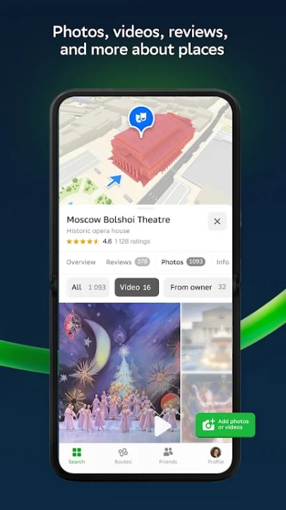
- Locate streets, buildings, districts, gas stations, sports grounds, and other urban points of interest
- Search for companies by name, service, or product to retrieve phone numbers, hours, entrance info, and postal codes
- Explore amenities such as free Wi-Fi areas, attractions, and transportation hubs using integrated travel guides
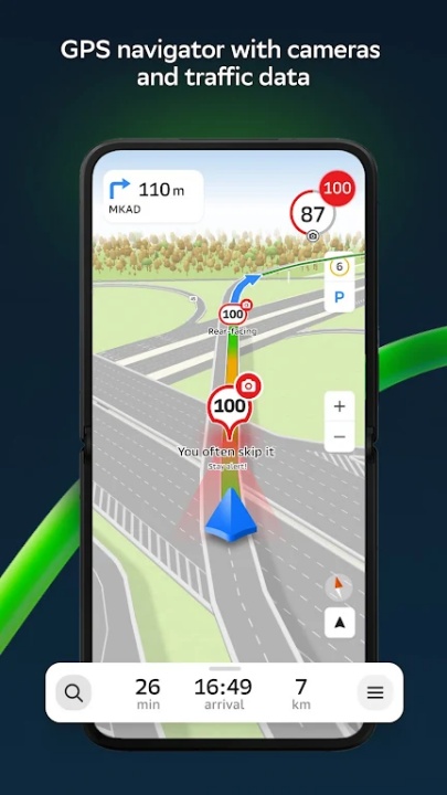
Real-Time GPS Navigation
- Turn-by-turn guidance for drivers with visual and voice navigation support
- Includes traffic-based routing, road signs, speed cameras, toll roads, and unpaved route detection
- Navigate across cities and through multiple destinations, even when minimized via picture-in-picture mode
- Fully compatible with Android Auto for seamless vehicle integration
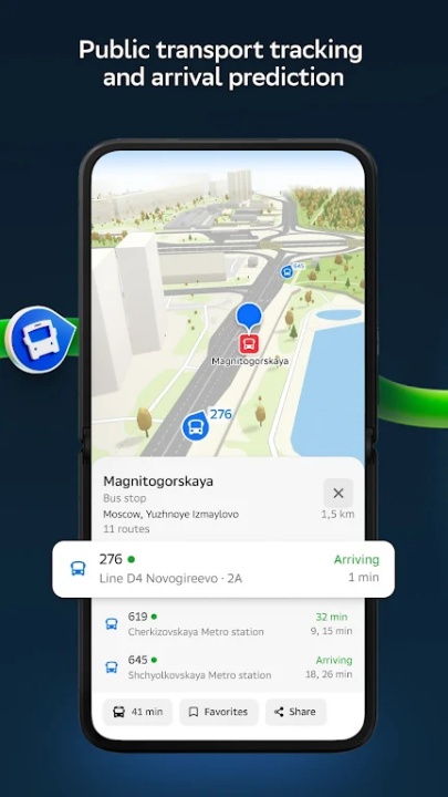
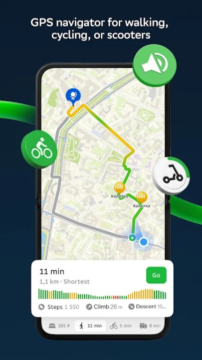
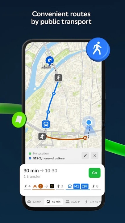
Pedestrian and Transit Routing
- Step-by-step pedestrian routes with voice guidance that operates in the background
- Access public transit schedules and live route updates including buses, trams, and metro systems
- Set directions based on departure or arrival times to optimize transit use across supported cities
Cargo Navigation for Trucks
- Configure truck-specific routing based on vehicle size, cargo type, and road limitations
- Avoid restricted areas, low-clearance roads, or weight-limited bridges to ensure legal and efficient travel
Social Location Features
- Track and display real-time friend and family locations on the map
- Control who sees your location via customizable visibility settings
- Manage safety by viewing proximity and adjusting contacts dynamically
Offline Maps and Global Reach
- Download maps for use without an internet connection—ideal for roaming or low-network areas
- Coverage includes cities in Russia, the UAE, Belarus, Kazakhstan, Uzbekistan, Azerbaijan, and Kyrgyzstan
- Offline routing supports vehicles, walking, and transit modes with full directory access
Wear OS Companion Integration
- Use the 2GIS Notifications app for smartwatches with Wear OS 3.0+
- Receive vibration alerts when approaching turns or stops during foot, bike, or transit navigation
- Automatic pairing with phone navigation initiates seamless wearable guidance
Incident Reporting and Road Awareness
- View user-submitted updates on road closures, accidents, and traffic delays
- Interact with local route reports to adjust navigation decisions in real-time
Frequently Asked Questions
Q: Does 2GIS support offline navigation?
Yes, users can download maps and use full navigation without internet.
Q: What modes of transportation does 2GIS support?
Driving, walking, public transit, and cargo routing are all supported.
Q: Can I see live traffic and road events?
Yes, traffic updates, accidents, and speed cameras are displayed in real time.
Q: Is Android Auto compatible with 2GIS?
Yes, 2GIS includes an Android Auto app for in-car navigation.
Q: How accurate is the address and company directory?
The directory includes verified details such as entrances, operating hours, and contact info.
Q: Can I view friends’ locations on the map?
Yes, with permission, you can see and share real-time location with contacts.
Q: Does 2GIS offer truck-specific navigation?
Yes, cargo mode calculates routes based on vehicle size and cargo type.
Q: Which cities are covered in the app?
2GIS provides maps for major cities across Russia, UAE, Central Asia, and Eastern Europe.
Version History
v3.19.10 —— 7 Jul 2025
Road event card behavior improved—swipe down to dismiss card in Navigator, consistent with other app modes
Home/Work address editing simplified—use long-tap gesture to update saved locations
General improvements and bug fixes—refinements to stability and interface responsiveness
v3.19.9 —— 6 Jun 2025
User Profile expanded—manage account details, uploaded photos, and now reviews directly from Profile (city availability varies)
Directory shortcuts restored—quick category access returned to search screen layout