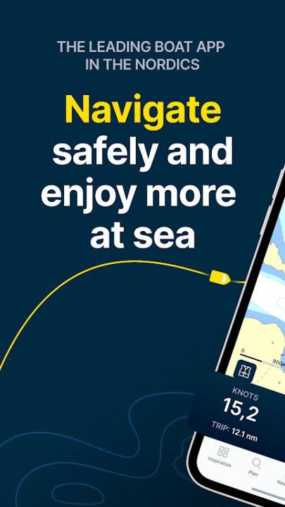
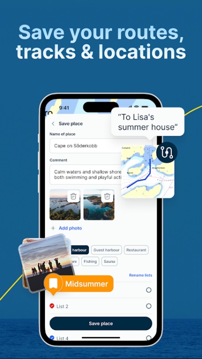
Skippo is a boating navigation platform designed to help users plan routes, explore destinations, and log their maritime adventures. With smart navigation features, detailed harbor guides, and real-time weather updates, Skippo ensures a seamless and safe boating experience.
Smart Navigation & Route Planning
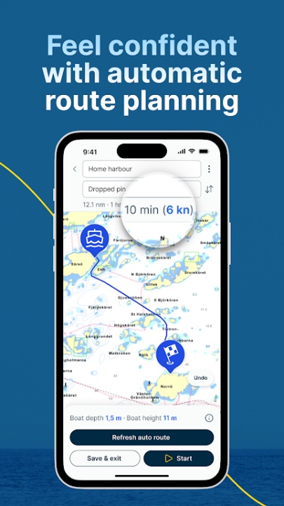
- Automatic Route Calculation – Get the fastest and safest path to your destination.
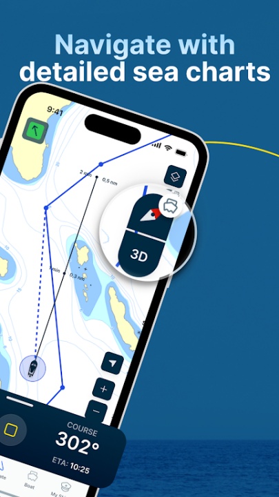
- Digital Nautical Charts – Access maps for Sweden, Norway, and Finland, with Danish charts available for purchase.
- Trip Meter & Speed Tracking – Monitor speed, course, and distance traveled.
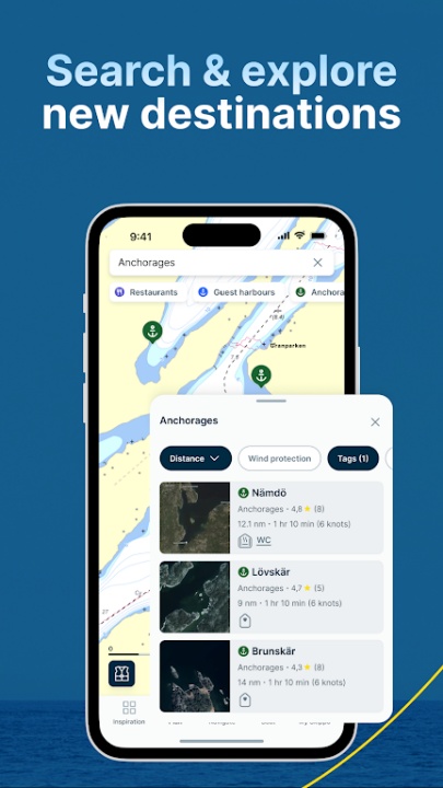
Harbor Guide & Destination Discovery
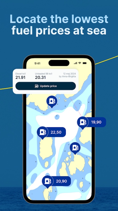
- Find Marinas & Seaside Restaurants – Locate nearby docking spots and dining options.
- Filter by Wind Direction & Facilities – Choose harbors based on anchorage type and amenities.
- Aerial Photos & Detailed Maps – View high-resolution images for better navigation.
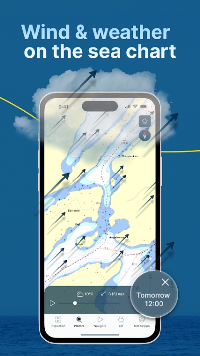
Weather & Safety Features
- Wind & Weather Integration – Optimize routes with real-time forecasts.
- Anchor Watch – Set alerts for secure anchoring.
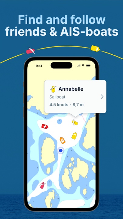
- AIS Boat Tracking – Follow nearby vessels for enhanced situational awareness.
Why Choose Skippo?
- Provides smart navigation with automatic route planning and digital nautical charts.
- Offers detailed harbor guides and destination discovery tools.
- Ensures safety with real-time weather updates and AIS boat tracking.
Frequently Asked Questions
Q: Can I plan boat routes with Skippo?
A: Yes, users can access automatic route planning for optimized navigation.
Q: Does Skippo provide nautical charts?
A: Yes, users can view digital maps for Sweden, Norway, and Finland, with Danish charts available for purchase.
Q: Can I track nearby boats with Skippo?
A: Yes, users can follow AIS boat movements for enhanced situational awareness.
Q: Does Skippo offer weather updates?
A: Yes, users can access real-time wind and weather forecasts for safer navigation.
Q: Can I find marinas and restaurants using Skippo?
A: Yes, users can locate docking spots, dining options, and fuel stations.
Version History
v10.2.1 ---- 5 Apr 2025
Night mode – Dark map and interface for better visibility at night.
Split-screen support on tablets – Navigate more smoothly with two views at once.
Upgraded Dashboard for tablets – Clearer and more customizable.
Show all tracks on the map – Easily review previous trips.
v10.1.5 ---- 20 Mar 2025
Night mode – Dark map and interface for better visibility at night.
Split-screen support on tablets – Navigate more smoothly with two views at once.
Upgraded Dashboard for tablets – Clearer and more customizable.
Show all tracks on the map – Easily review previous trips.
v10.1.3 ---- 15 Feb 2025
Night mode – Dark map and interface for better visibility at night.
Split-screen support on tablets – Navigate more smoothly with two views at once.
Upgraded Dashboard for tablets – Clearer and more customizable.
Show all tracks on the map – Easily review previous trips.