Visorando is a comprehensive outdoor navigation platform designed to help users explore curated walking routes, track their location, and plan custom hikes effortlessly. With offline GPS functionality, detailed maps, and route customization, Visorando ensures a seamless and enriching outdoor experience.
Extensive Route Selection & Customization
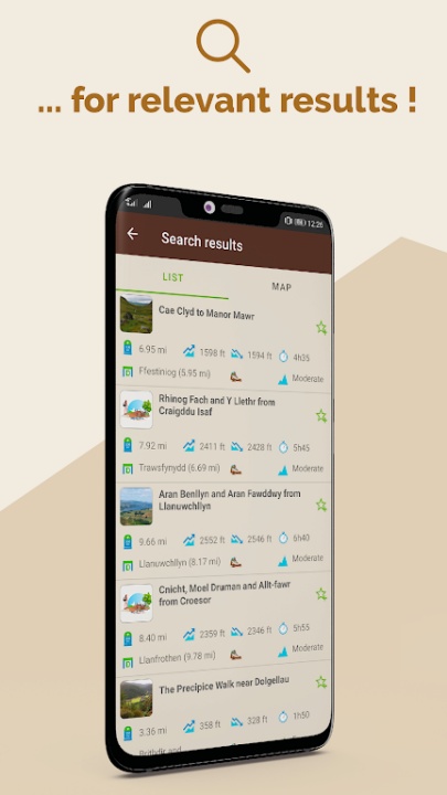
- Access over 26,000 curated walking routes worldwide, including 3,500 in English.
- Choose routes based on location, difficulty level, and duration.
- Explore paths in mountains, countryside, coastal areas, forests, and cities.
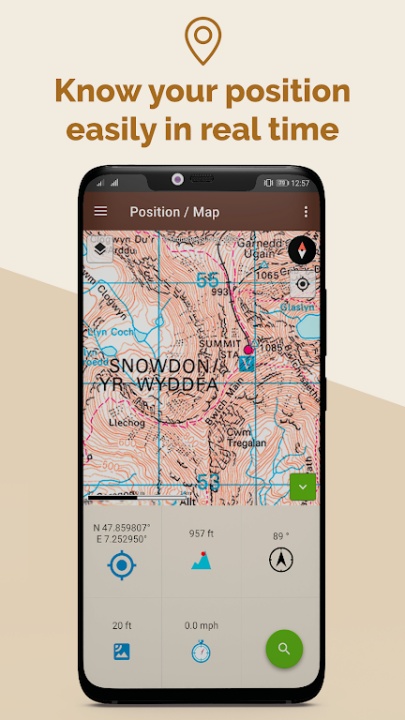
Offline Navigation & Real-Time Tracking
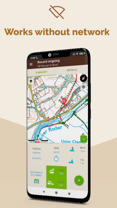
- Download routes for offline use and follow them without an internet connection.
- View live location updates and track progress on the map.
- Receive alerts when deviating from the planned route.
Custom Route Planning & Recording
- Plot personalized routes using the built-in route planner.
- Record live routes, track distance, duration, and elevation gain.
- Import GPX files for seamless integration with other navigation tools.
Visorando Premium Features
- Access high-definition topographic maps with elevation and depth details.
- Utilize 3D aerial and satellite imagery for enhanced terrain visualization.
- Share live location with loved ones for added safety.
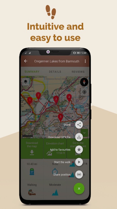
Community-Driven Content & Verified Routes
- Contribute routes to the platform and share experiences with fellow hikers.
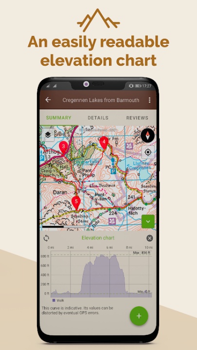
- Benefit from verified route descriptions, elevation charts, and user reviews.
- Organize and categorize saved routes for easy access.
Frequently Asked Questions
Q: How does Visorando help with offline navigation?
A: Users can download routes and access GPS tracking without an internet connection.
Q: Can I create my own walking routes?
A: Yes, users can plot custom routes and record live hikes.
Q: What additional features does Visorando Premium offer?
A: It includes 3D maps, elevation details, live location sharing, and offline navigation.
Q: How does Visorando ensure route quality?
A: Submitted routes undergo verification by a team of volunteers before publication.
Q: Can I import GPX files into Visorando?
A: Yes, users can import GPX files for seamless route integration.
Version History
v3.13.2 ---- 28 May 2025
Community event reporting—users can now report obstacles, technical passages, animals, and risks on their route.
Elevation source selection—choose between GPS elevations or the Digital Elevation Model for better accuracy.
Deep link fixes—resolved issues with forum and rating links.
v3.13.1 ---- 13 May 2025
Community event reporting—same feature as v3.13.2 for collaborative route updates.
Elevation source selection—users can now choose between GPS elevations or the Digital Elevation Model.
v3.13.0 ---- 6 May 2025
Community event reporting—users can now report obstacles, technical passages, animals, and risks on their route.
Elevation source selection—choose between GPS elevations or the Digital Elevation Model for better accuracy.