


Trail Sense
Your Ultimate Wilderness Companion
• Reclaim your sense of adventure and step beyond the digital world.
• Trail Sense is built for those who seek the freedom of the great outdoors—whether you are hiking rugged peaks, backpacking through deep forests, or geocaching in the unknown.
• This is more than an app; it is a versatile toolkit designed to empower your journey where the internet cannot follow.
Navigate with Confidence
• Use digital beacons to mark your path and find your way back.
• Orient yourself with a high-precision compass tailored for the trail.
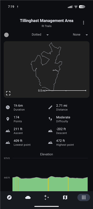
• Record your movement and use the backtrack feature to safely retrace your steps.
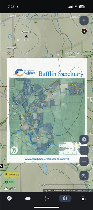
• Turn any image into a functional map to guide your exploration.
Master the Elements
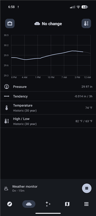
• Anticipate shifts in the atmosphere with barometric weather forecasting.
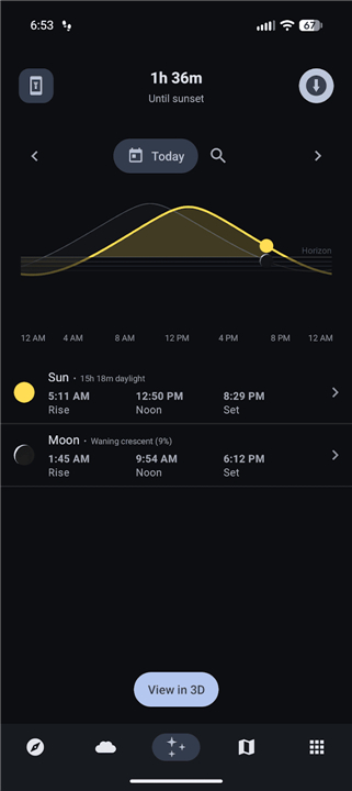
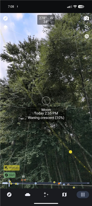
• Receive alerts before dusk so you are never caught unprepared by the setting sun.
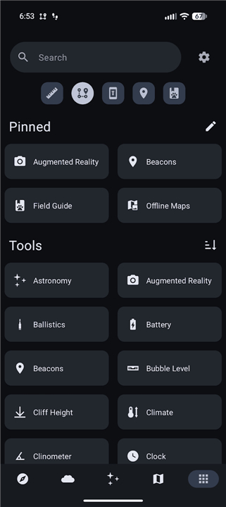
• Utilize the built-in flashlight and essential tools like the water boil timer and clinometer.
• Organize your expedition with integrated packing lists and distance tracking.
Absolute Privacy and Independence
• Operation is entirely offline; your phone’s internal sensors provide all the data you need.
• Your information never leaves your device, ensuring total privacy in the wild.
• Open-source and community-driven, this tool is built for reliability without hidden tracking.
A Note on Safety and Hardware
• Trail Sense is a powerful supplement to your outdoor kit, but it should never replace traditional skills or backup tools like a physical compass.
• Specific features, such as the compass and weather forecasting, require your device to have the necessary hardware sensors (magnetometer and barometer).
• Accuracy is subject to sensor quality and external conditions; always prioritize your safety and use at your own risk.
Support and Development
• As an independent developer, I am committed to refining this tool for the global hiking community.
• If you encounter an issue or have a vision for a new feature, you can contribute via GitHub or reach out directly at trailsense@protonmail.com.
FAQ
Q: Do I need active cell service or an internet connection to use Trail Sense?
A: Not at all! Trail Sense operates entirely offline by relying directly on your smartphone's internal sensors. You can confidently venture deep into remote wilderness areas without worrying about lost cell service or data coverage.
Q: How does Trail Sense protect my privacy and personal location data?
A: Your personal data and location information stay completely on your device and are never transmitted anywhere else. Trail Sense is open-source and community-driven, which means there is no hidden background tracking, telemetry, or remote data storage.
Q: How do digital beacons work within the app to help me navigate?
A: Digital beacons act as virtual landmarks that you can set along your journey to mark important locations like campsites, water sources, or trailheads. You can use these saved points alongside the high-precision compass to orient yourself and easily navigate your way back whenever needed.
Version History
v8.1.1——5 Aug 2026
Use your phone's sensors to assist with wilderness treks Download the latest version of Trail Sense to enjoy new features and updates immediately!
*8.1.1
Offline Maps
- Automatically detect corners of new photo maps
- Add setting to use external trail map files
Pedometer
- Show hourly step count history, pace, and active time
- Add option to use active or elapsed time for average pace
Astronomy
- Render accurate icons for moon and eclipses
Field Guide
- Add Record Sighting quick action
Survival Guide
- Content updates
Misc
- Improve Material 3 Expressive support
- Location input fields allow selecting a location on the map
- Bug fixes
*8.1.0
Offline Maps
- Automatically detect corners of new photo maps
- Add setting to use external trail map files
Pedometer
- Show hourly step count history, pace, and active time
- Add option to use active or elapsed time for average pace
Astronomy
- Render accurate icons for moon and eclipses
Field Guide
- Add Record Sighting quick action
Survival Guide
- Content updates
Misc
- Improve Material 3 Expressive support
- Location input fields allow selecting a location on the map
- Bug fixes
*8.0.2
Offline Maps
- Automatically detect corners of new photo maps
- Add setting to use external trail map files
Pedometer
- Show hourly step count history, pace, and active time
- Add option to use active or elapsed time for average pace
Astronomy
- Render accurate icons for moon and eclipses
Field Guide
- Add Record Sighting quick action
Survival Guide
- Content updates
Misc
- Improve Material 3 Expressive support
- Location input fields allow selecting a location on the map
- Bug fixes