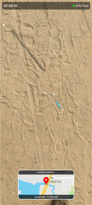



Geotag Video Camera
Overview
• This advanced recording technology seamlessly integrates precise geographical information directly into video files.
Product Concept & Definition
• A Geotag Video Camera is an innovative recording device designed to capture both visual footage and accurate geographical coordinates simultaneously.
• Its primary function is to embed rich contextual metadata, automatically linking "where" a video was shot to "what" is being recorded.
Core Functionality: Location-Embedded Recording
• Simultaneous Data Capture: While recording video, the camera actively acquires GPS (Global Positioning System) satellite signals to determine its exact location.
• Direct Metadata Integration: This real-time location data, including latitude, longitude, altitude, and precise timestamps, is automatically embedded within the video file's metadata.
• Enhanced Context: Every segment of a recording is thus permanently associated with its unique geographical point of capture, providing invaluable spatial context.
Technical Implementation: On-Device Geotagging
• In-Camera Processing: The critical distinguishing feature is that the geotagging process occurs entirely in real-time, directly within the camera itself.
• No External Dependencies: This eliminates the need for external GPS loggers, subsequent manual syncing, or post-production software to add location data.
• Standardized Formats: Location information is typically written into common video file formats (e.g., MP4, MOV) using established metadata standards like XMP or EXIF, ensuring broad compatibility.
Practical Applications & Benefits
• Travel Documentation: Automatically mapping routes and points of interest for personal travelogues or adventure filmmaking.
• Field Research & Surveys: Providing undeniable geographical proof for environmental studies, land surveys, or construction progress tracking.
• Security & Incident Reporting: Offering precise location context for surveillance footage, accident scenes, or investigative documentation.
• Content Creation: Enhancing vlogs, documentaries, and educational content with automatic, accurate location stamps.
FAQ
Q: How does the camera manage to record my location while I am busy filming?
A: The camera features an integrated GPS receiver that actively communicates with Global Positioning System satellites throughout the recording process. As you move and film, the device constantly acquires signals to determine your exact position on Earth and seamlessly integrates this data into the video file as it is being written to the memory card.
Q: What specific types of geographical information are stored within the video’s metadata?
A: When you use one of these cameras, the embedded metadata typically includes your exact latitude and longitude coordinates. Additionally, most devices will record your altitude to show elevation changes and provide highly accurate timestamps that are synchronized with satellite time to ensure the spatial context is as precise as possible.
Q: Does this technology require me to carry a separate GPS logger or use a smartphone app?
A: One of the most significant advantages of a Geotag Video Camera is that it is entirely self-contained. The geotagging process occurs through in-camera processing, which means you don't have to worry about external dependencies, manual syncing in post-production, or carrying extra gear to ensure your location data is captured.
Version History
v2.5.5——16 Sep 2026
Capture videos with real-time GPS location metadata. The Geotag Video Camera automatically embeds coordinates, altitude, and timestamps. Download the latest version of Geotag Video Camera to enjoy new features and updates immediately!
*2.5.5
Minor bug fixes and improvements. Install or update to the newest version to check it out!
*2.5.4
Minor bug fixes and improvements. Install or update to the newest version to check it out!
*2.5.3
Minor bug fixes and improvements. Install or update to the newest version to check it out!